Posts Tagged With: dispersed camping

Crosho Lake

We took this trip the first weekend of June 2012. Camping the first weekend of June?! Well, normally that’s a pretty chilly weekend but because of the dry winter and hot spring we gave it a go. Of course, we ended up happy we did it as soon after the fires began raging out of control and the statewide fire ban was put in place. It was a bit chilly at times and we had a few storms…but plenty of good weather to enjoy this gem of a spot!

Getting there: To get to Yampa from Denver we took 170 to Silverthorne and then hwy 40 to 134 and then 131. You may continue on 170 to the Steamboat exit as well…… From Yampa, go 4 miles west on county rd 17 then 6 miles west on county rd 15.

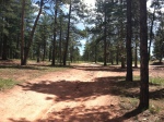
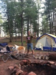
This is a small “campground.” No fees, reservations or host…but there was a vault toilet. 10 spots. It was fairly full when we pulled in Friday afternoon. We pulled up next to the lake and repaired a fire pit and had a great spot! This was a group camping trip for us so there were actually 2 very large spots side by side. We thought this was Crosho Lake…as it turns out you go a few feet from our campsite up a little bluff and there is the bigger lake. However, we loved camping right next to this littler lake. This area is beautiful and it was very quiet despite having people nearby. Great hiking trails as well. You are in Routt National Forest.

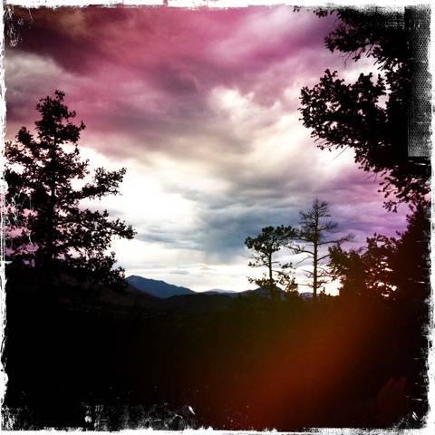
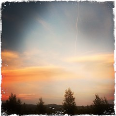
Here is a slideshow showing the area…including other views of the campground and both lakes.

This slideshow requires JavaScript.

Categories: Flat Tops Wilderness | Tags: , , , , , | 1 Comment

Rainbow Falls

We returned to Rainbow Falls area for a second trip. After a stop in Woodland Park; the road to Rainbow Falls is nearby. This is a heavy traversed area for ATV’s. The first area we arrived at was a huge parking lot and bathrooms…as we continued down the road there are many spots where ATV’ers can camp and then use the road for play. If this is you…great! If this is not you…you need to head UP! There are a few roads that begin to go up above the main ATV area. This is where we went. The views are fabulous and the spots are large and plentiful. This is not an area with any water nearby…just basic wooded camping. For entertainment we continued to explore the roads and the views. There are 4 by 4 trails and walking trails.  You are in Pike National Forrest.

Getting there…..
From Woodland Park take Hwy 67 for 10.5 miles north
Rainbow Falls road will be on your right

20110725-082017.jpg

Categories: Uncategorized, Woodland Park | Tags: , , , , , | Leave a comment

Bunce School Trail

This is a quick dispersed spot to get to from Hwy 7….on the way to Allenspark. Our kids go to camp every summer at Highlands Presbyterian Camp which is just around the corner. So, we decided to pick them up and have them live without showers another day or so! The Bunce School Trail Head is a popular 4 wheel drive area–it also connects to Camp Dick and can go through Peaceful Valley. We found this spot just past the historic Bunce School. It is a pretty busy area. There were lots of ATV trails as well and Saturday was a pretty heavy day for them to be whizzing past our campsite. We took out my brothers jeep on a few roads and there are great views. This really isn’t the site for peace and quiet, however. We were camping in a tent this particular weekend…but a pop-up could easily get into the area. This was a really quick trip for us and we didn’t really look for a long time for a spot. I do think this area provides many other spots–particularly through the Peaceful Valley and next to the Vrain river. Plan to explore this more at some point!

Getting there:

Bunce School Trailhead: Take Highway 7 from Lyons to Allenspark. After the turnoff for Highway 72, there is a brown sign for a “Point of Interest.” Follow the sign, and you’ll find yourself at the old Bunce School and the northern start of the Bunce School trail.

This is actually a great spot for a family photo—Christmas cards or whatever!

Kelsey thinks so too 🙂 She always is willing to pose for us!

Categories: Raymond/Allenspark | Tags: , , , | Leave a comment

Woodland Park–Rainbow Falls

This was a group camping trip in the Woodland Park area. We went to an area called Rainbow Falls. There are lots of dispersed camping throughout the area. This is also a popular ATV area. It connects to Rampart Range and that’s where you find the camping that is set up for ATV type vehicles. This, of course, causes for noise concern. But, where we ended up it was pretty quiet–aside from the occasional bouts of shooting. Remember that national forest camping often means shooting.

Getting there…..
From Woodland Park take Hwy 67 for 10.5 miles north
Rainbow Falls road will be on your right

Categories: Woodland Park | Tags: , , , | 1 Comment

Leadville

This dispersed camping area had easy access to a reservoir and a small river…with camping on the river. The spots can be challenging to get down into depending on the spot…but the road is easy. This is Clear Creek Reservoir.

Getting there…..
170 west to exit 195
Co-91 S
Go to Hwy 24 west
Trail Road on your right
Go past reservoir….past private property….then dispersed camping will begin

20110625-105142.jpg

20110625-105156.jpg

20110625-105204.jpg

20110702-081809.jpg

Categories: Leadville | Tags: , , , , | Leave a comment

Devils Canyon

This is one of the best sites we have had! Although getting to Devil’s Canyon is a bit of an adventure. The 4 wheel drive road is a firm moderate….no problem for those that regularly do off road trails. Slow driving got our Envoy up the road…..

Getting there..
170 west to exit 240-Mt. Evans Road
Go to 10 mile marker….just past this about .3 mile is the Devil’s Canyon Road on your left….easy to miss. From here, stay on A road. It forks left then right….about 20 minutes up you will come to the loop…go right. This spot will be on your left. If you go a bit further and take a right on an almost hidden road there is another great spot.

IMPORTANT: Always stay to Road A! Signs can be confusing.

We had the mountain to ourselves it seemed! We saw very few others. Spectacular views.

The Panoramic View……..

20110703-103548.jpg

Categories: Idaho Springs | Tags: , , , , | 2 Comments

Cascade Creek Road

We started off with the intention of going to Devil’s Canyon off of Mt. Evans road. Although it was after June 15th–the road was still closed. So, we headed up Cascade Creek Road to find camping and 4 wheel drive trails.

How to get there:
1-70 west from Denver
Exit 240 Idaho Springs–turn left
This puts you on the Mt. Evans Road
Mile marker 5–go past half mile and you will see the road on your right.

This road is rated moderate (blue) with regards to 4 wheel driving. We had our Envoy and pop-up. It is slow going and rocky. The pop-up actually has more clearance than our Envoy–as the axle is reversed. Not too far up, there is a camping spot to your right. This may be about as adventurous as most want to be and somehow we missed it going up the first time. At 710.01c we did the switch back and kept climbing. Then you come to a dead end road that you can turn on to your right. Any higher on the road–we couldn’t get up. My brother came up in his jeep and later we explored the rest of the road that took us to the top. So, we backed the pop-up down the narrow road as far as we could go and when we were directly above a small tent-site and campfire ring. We popped up on the top of the road–my brother set up his tent below. Not too bad–the kids had the rest of the road to explore. No traffic turned down the road during the weekend.

20110621-073827.jpg

20110621-073853.jpg

20110621-073927.jpg

20110621-073946.jpg

20110621-074013.jpg

20110621-074047.jpg

20110621-074148.jpg

20110621-074212.jpg

Categories: Idaho Springs | Tags: , , , , | Leave a comment

Create a free website or blog at WordPress.com.